
New Perspective’s Media and Advertising maps are often the best tool for visualizing the coverage of various media vehicles into target populations. New Perspective has provided these insights to dozens of media companies including print, broadcast and direct mail. Our media maps often include target household coverage themes and advertiser/customer locations and trade areas. Enhance your next sales presentation with a clear picture of your vehicle’s coverage of target households or use these maps to tailor your distribution to key customers.
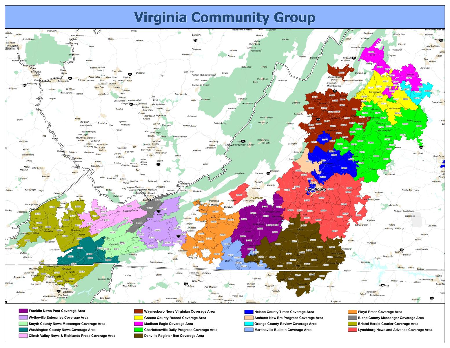 Group distribution overview map with color-coded publications. Used for marketing and sales materials.
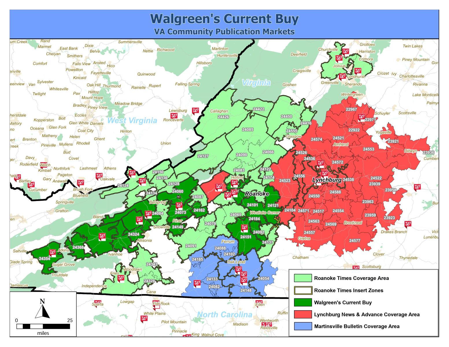 Existing print media buy illustrated over advertiser locations.
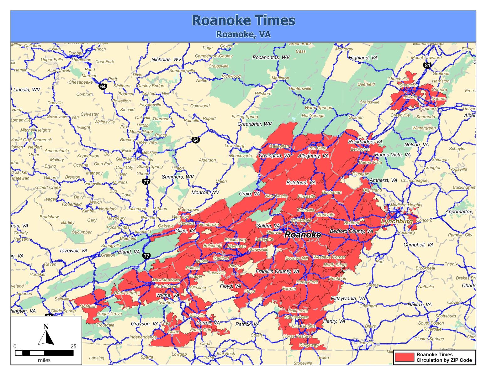 Newspaper circulation footprint map for marketing and advertising sales materials.
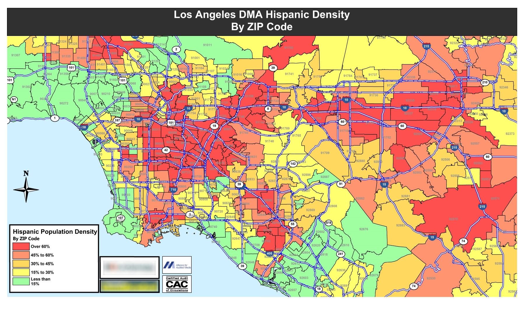 New Perspective has assisted numerous ethnic media companies to identify target households and market trends. Here Hispanic population density in the Los Angeles DMA is illustrated thematically. Advertisers seeking to reach Hispanic households were directed to these key areas through our client publication.
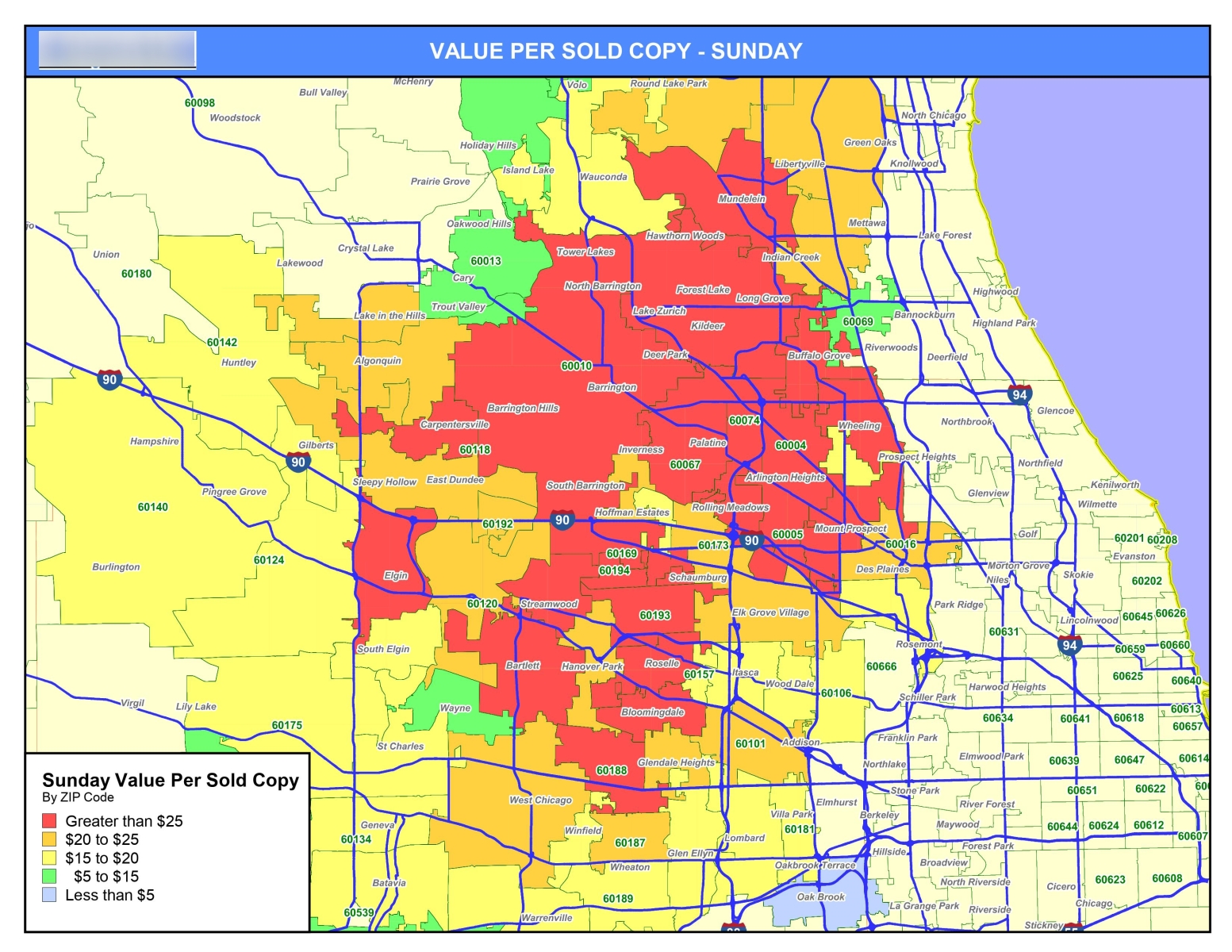 New Perspective was tasked with identifying the most valuable distribution ZIP Codes for print media vehicle. Advertising buy data was aggregated against distribution totals to identify "Value per sold copy". These ZIP Codes became top priority for sales efforts.
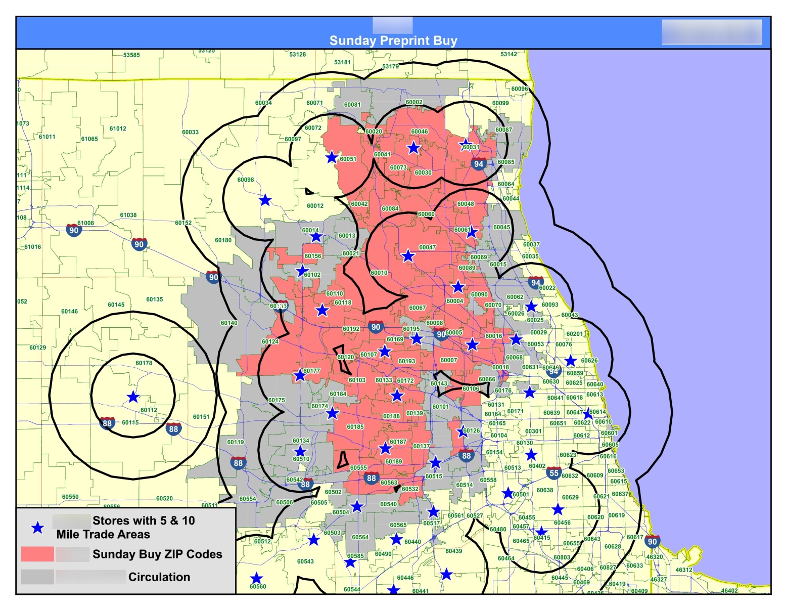 Print media market analysis. Existing store locations with defined trade areas are plotted over existing print advertising buy and additional prospective areas.
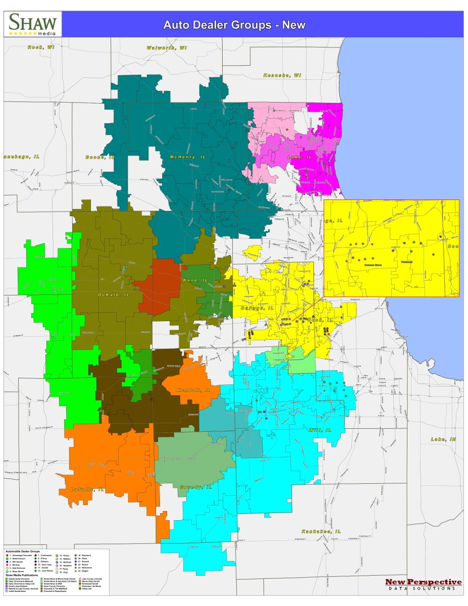 Market map illustrating auto dealer locations relative to newspaper group distribution footprint. Includes an inset for extra detail in high density area. Publications color-coded.
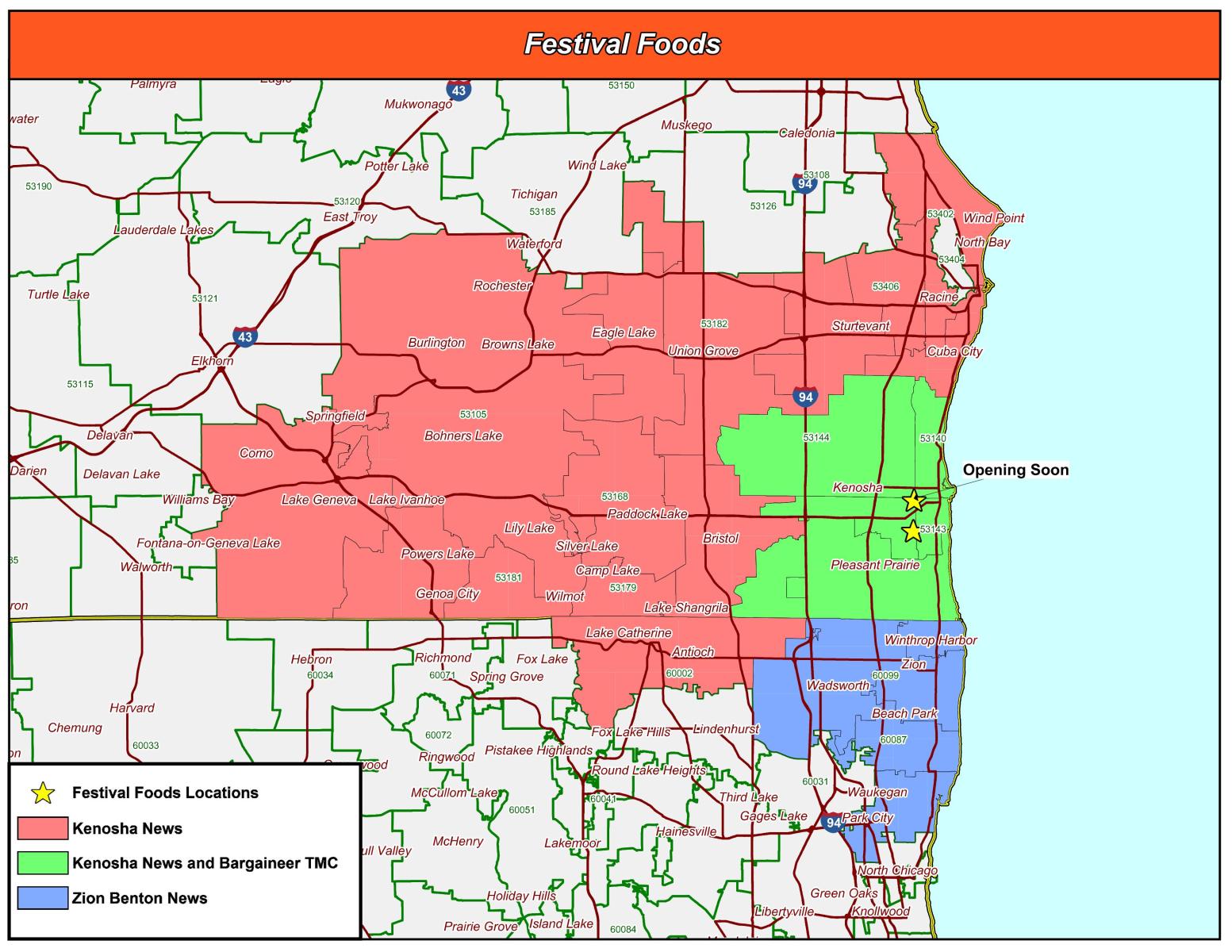 Advertising zones illustrated in relation to existing and grand opening store locations.
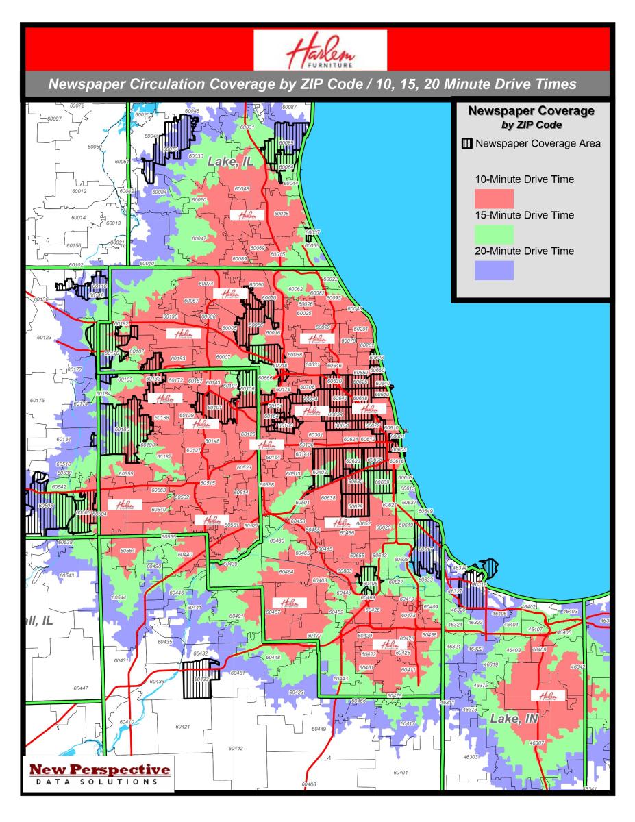 Retail locations plotted with 10, 15, and 20 minute drive times underneath print media delivery areas. Map was used to sell advertising by identifying overlap between prospective customers and delivery areas.
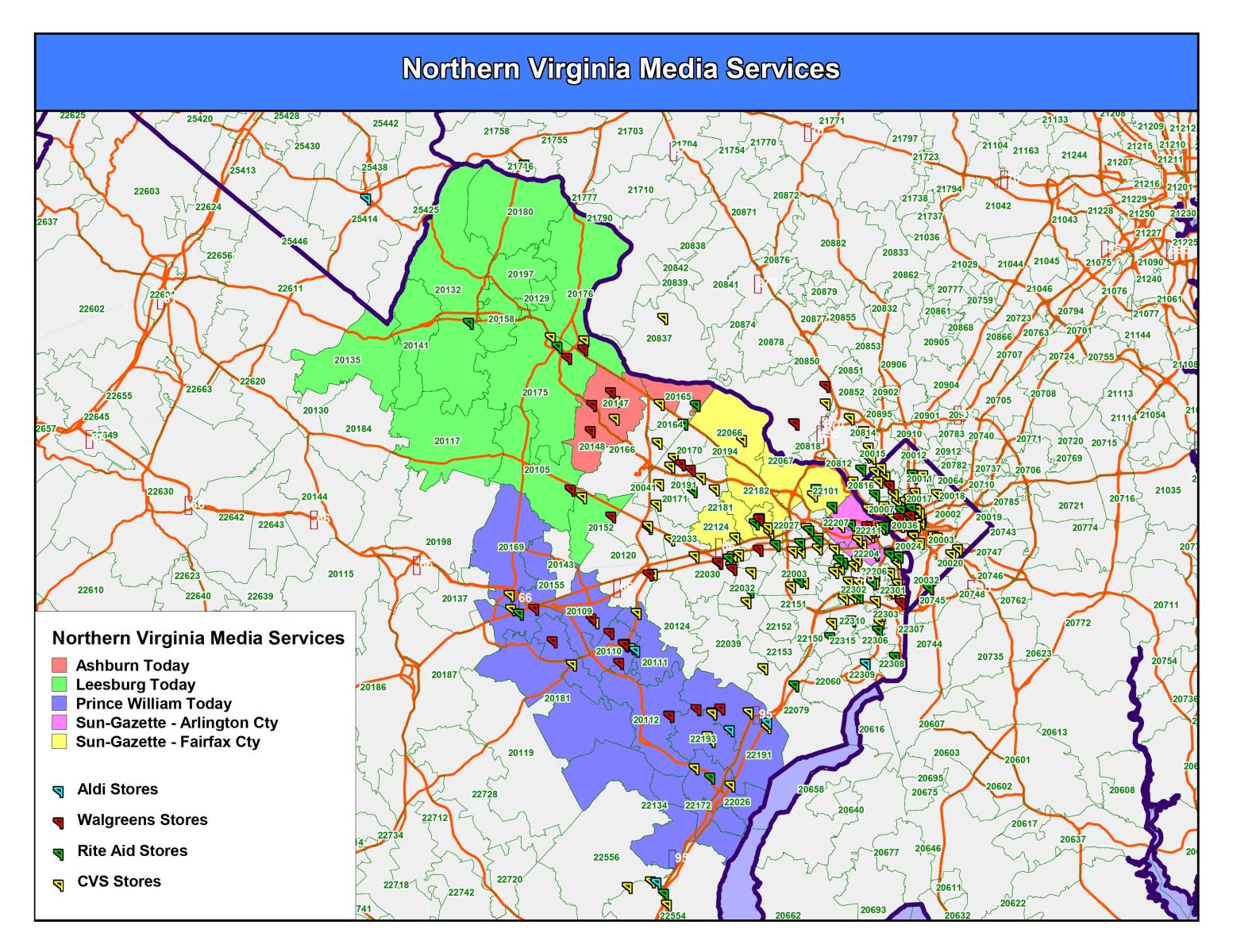 Category map for print media vehicle. This map was used to sell advertising among quick service pharmacy providers.
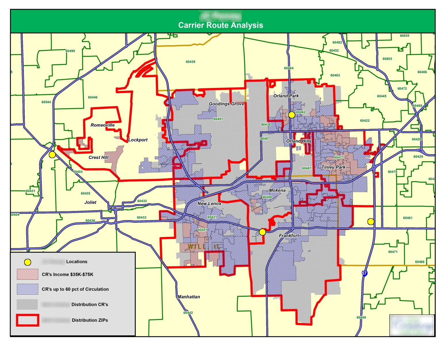 Advertising zone development map. Carrier routes were mapped and analyzed incorporating delivery volume and demographic data to determine optimal advertising zones.
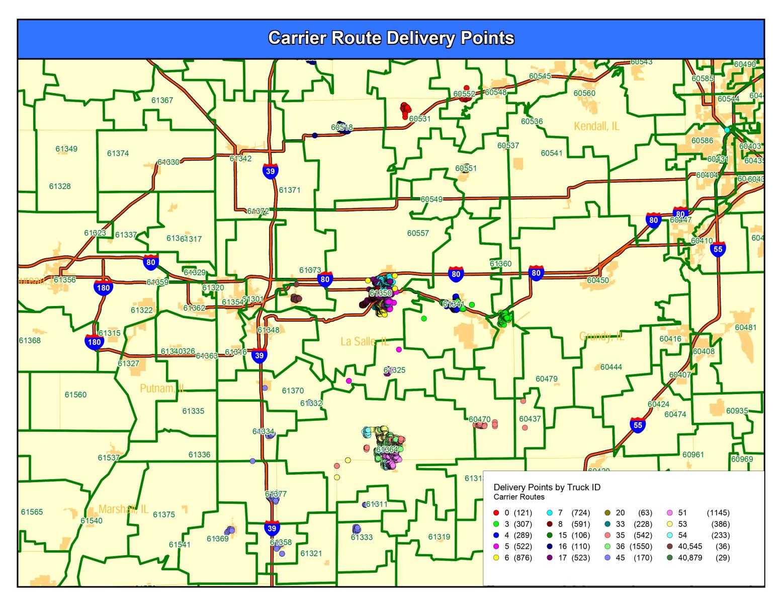 Print media distribution planning map. Existing carrier route drop points were geocoded and color-coded. This data was eventually used to develop advertising delivery zones.
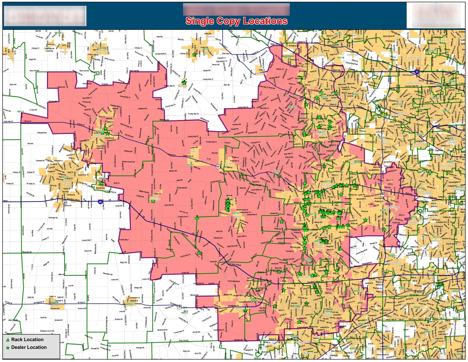 Pick-up points and distribution drop-points for print media vehicle plotted over home delivery circulation footprint and detailed street data. Customer was considering a "single-copy" advertising program and needed to understand locations of pick-up points within market.
Want a quick quote? Fill out the information below with your map needs and we will respond as soon as possible with a quote and timeline.